Military Map in Travel Animator
 Jaseel S6 min read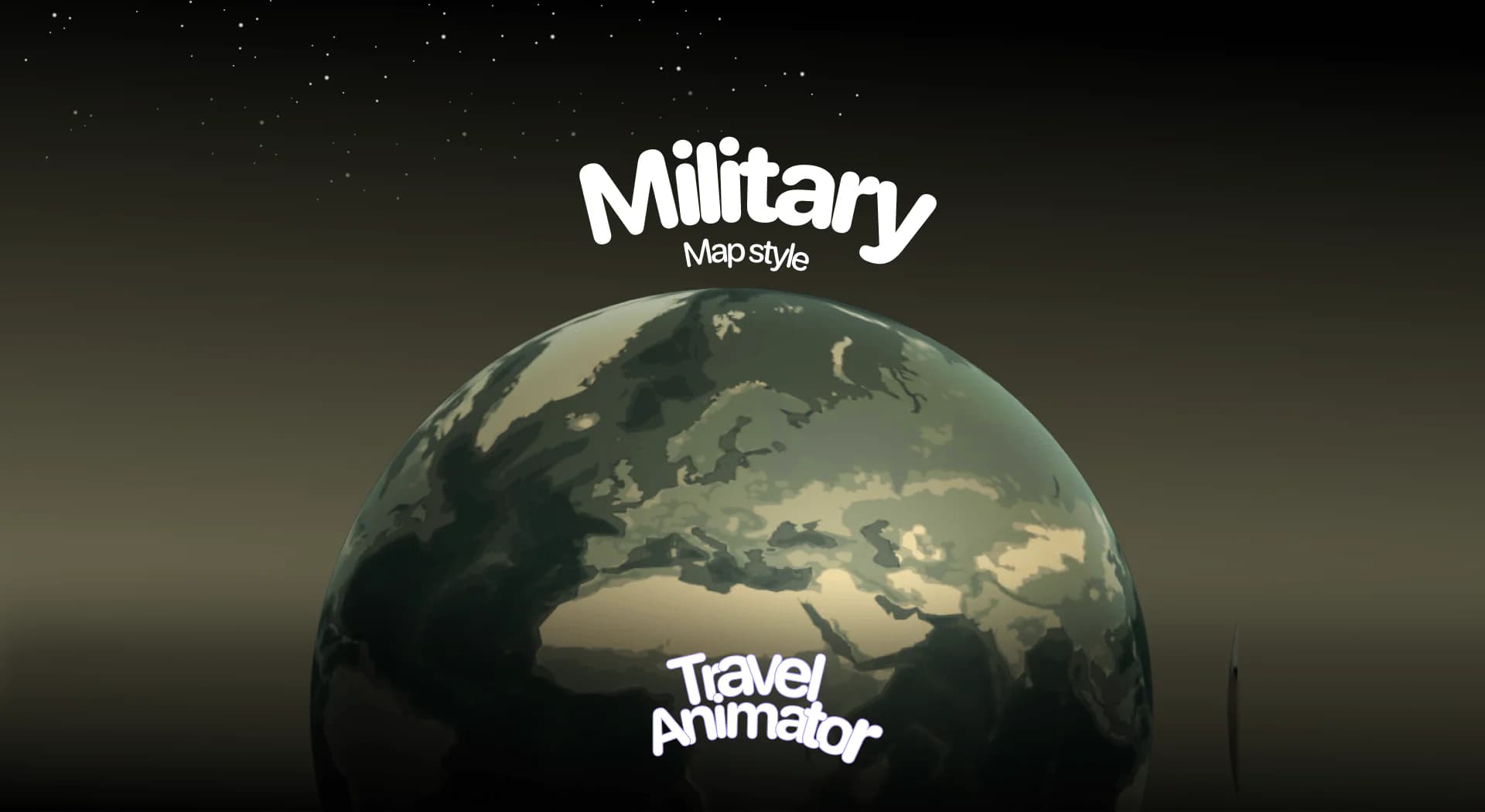
In this article 9 sections
Military Map is a newly released map style in Travel Animator that gives your travel animations a bold, tactical look, perfect for adding intensity and drama to your stories.
Imagine you are creating a war-themed documentary, and finding the best map style instantly sets the tone with its strong, mission-driven aesthetic.
Let’s explore the Military Map Style in Travel Animator, its use cases, and how to use the map in your travel videos.
What Is the Military Map Style in a Travel Animator?
The Military Map Style is new in Travel Animator, which features earthy colors, dark contrasts, and clear labels that make the map often seen in documentaries, war films, or mission-oriented films.
It highlights borders, terrain, and locations in a way that feels serious, professional, and mission-driven. By applying this style, your travel route animations get a bold edge that captures toughness, curiosity, and the intensity of thrilling adventures.
Is the Military Map Style Free or Premium?
Military Map Style is a part of Travel Animator’s premium map collection. Upgrade the Travel Animator app to activate the Military Map in your travel video. Along with that, you can use other premium features like pro models, 4K export without watermarks, and more features to make your travel video professional and attractive.
It is now available for free for the first 30 days from the release day, so you can experiment with it risk-free before upgrading to keep using it in your long-term projects. But the output is comparatively less attractive because other premium features are not available in the free trial.
How to Use the Military Map Style in Your Project - Step-by-step procedure
- Open the Travel Animator app and upgrade the app after signing in with an email address.
- Select your travel routes and add images and labels at different stops.
- Preview the video and go to the map menu.
- Scroll through the available map styles until you find Military.
- Tap Select to apply the Military theme to your project.
- Toggle Place Labels ON or OFF depending on whether you want cities and country names displayed.
- Preview the animation with the Military style applied in 2D or 3D mode for the best effect.
- Save and share your project to share it across social media, presentations, or video content.
Who Can Use the Military Map Style?
- Gamers and Streamers can create strategy, mission-based, or war-themed travel animations.
- Teachers and students can illustrate routes in history, geography, or war-related content.
- Military Map is perfect for content creators who want to make their route animations feel serious, daring, or mission-driven.
- Travelers who want their travel videos to look bold and commanding, like a mission briefing.
Getting a Clean Look on the Military Map
The Military style is dark and earthy, so the biggest risk is a route line that disappears into it. A few settings make a real difference:
- Route line: pick a colour that contrasts with the olive and brown tones, like a bright red, yellow or white. A Medium or Thick line reads better on phones, and a dashed style feels right for a mission-briefing look. You can change all of this from the route line settings.
- Vehicle: match the model to the theme. Real models include an army tanker, and a jeep suits off-road or patrol-style routes. Real models are part of Pro.
- Countries: use the Highlight feature to fill the countries or states the route passes through. Pick a colour, pattern and border thickness that stand out from the map, and choose Current or Visited depending on the story.
- Labels: turn Place Labels on only if the names help. For a short reel, a few of your own labels at key stops usually read better.
Example: A History Class Route
Picture a teacher animating Napoleon’s 1812 march into Russia. The route has four stops: the crossing of the Neman River, Smolensk, Borodino and Moscow. On the Military map the land looks like a campaign chart, which suits the lesson.
To build it, search each place by name, and for battlefield sites that don’t come up cleanly, enter the coordinates directly in the search bar. Add a short text label at each stop with the date. Highlight the countries the army crossed so students can see the scale. Then export in 16:9 for the classroom projector, in 4K if you can, so small labels stay sharp on a big screen.
The same setup works for a gaming channel explaining a strategy map or a documentary-style recap of a long overland expedition.
When Another Map Style Fits Better
Military sets a serious, tactical tone. That’s great for war history, strategy content and rugged expeditions, but it can feel heavy for a family holiday or a food tour. If you want something historical without the tactical edge, the Ancient map style gives an old-world, storybook feel. For bright, friendly videos, a lighter style will suit the mood better. Since you can switch map styles in preview without rebuilding the route, try two or three before you export.
Is the Military Map Style a Good Choice for your Project?
The Military Map Style is an excellent choice for storytellers, educators, gamers, and adventurers who want to give their content a strong, mission-like feel. With a free 30-day trial now, you can easily test it out and decide if it fits your content style. Upgrade Travel Animator to get access to all premium features to get a professional Military Map Style animation.
Frequently Asked Questions
What Is the Military Map Style in a Travel Animator?
The Military Map Style is new in Travel Animator, which features earthy colors, dark contrasts, and clear labels that make the map often seen in documentaries, war films, or mission-oriented films. It highlights borders, terrain, and locations in a way that feels serious, professional, and mission-driven.
Is the Military Map Style Free or Premium?
Military Map Style is a part of Travel Animator’s premium map collection. Upgrade the Travel Animator app to activate the Military Map in your travel video.
Who Can Use the Military Map Style?
Gamers and Streamers can create strategy, mission-based, or war-themed travel animations. Teachers and students can illustrate routes in history, geography, or war-related content.
Why is my route hard to see on the Military map?
The Military map uses dark, earthy colours, so muted or dark route lines blend in. Open the route line settings and pick a bright, contrasting colour such as red, yellow or white, then increase the thickness to Medium or Thick. Preview the video on your phone, since thin lines that look fine in the editor can vanish on a small screen.
Which vehicle models suit the Military map style?
Models that match the tactical theme work best. Travel Animator’s real models include an army tanker, and a jeep fits patrol or off-road routes. For historical campaigns, pick a model that makes sense for the era and terrain so the video stays believable. Real models are included with Travel Animator Pro.